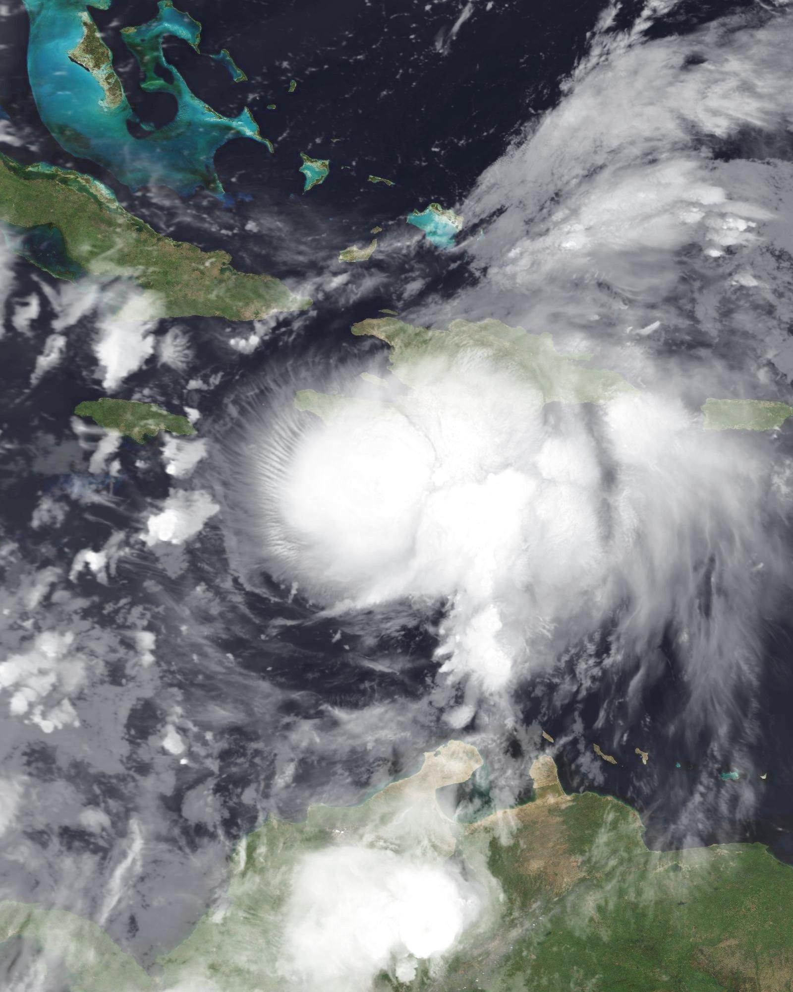
As the warm waters of the Atlantic pulse with potential, meteorologists are closely monitoring a developing weather system expected to transform into Tropical Storm Ernesto within the next 24 hours. With its projected path leading toward the Leeward Islands by Tuesday, communities in this picturesque region are bracing for the impact of nature’s forces. While the exact trajectory and intensity remain uncertain, forecasters urge residents to stay informed and prepared. In this article, we delve into the latest updates on Ernesto’s formation, its anticipated effects on the islands, and the measures local authorities are taking to ensure safety in the face of the storm’s approach.
Tropical Storm Ernesto: Forecasted Development and Timeline of Impact
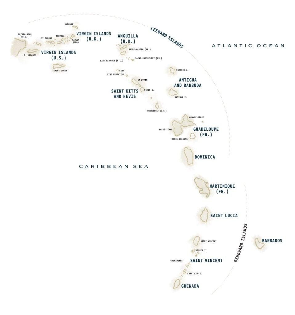
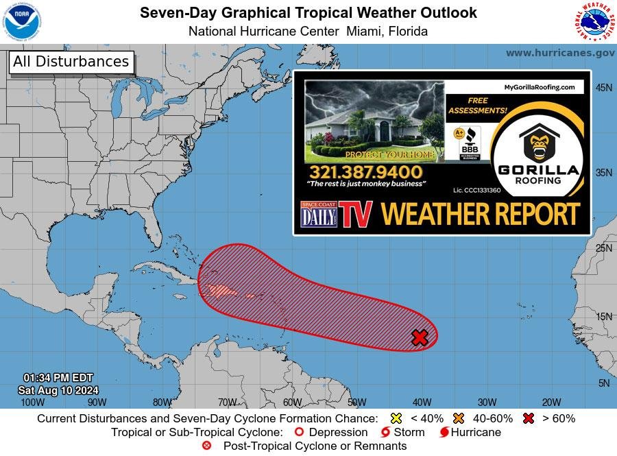
The latest weather models indicate that a significant system is expected to form within the next 24 hours, potentially evolving into Tropical Storm Ernesto. As it develops, meteorologists are closely monitoring its trajectory, which appears to direct it towards the Leeward Islands. Communities in these areas should prepare for possible impacts starting Tuesday, as the storm’s path could bring heavy rainfall, strong winds, and coastal flooding along with it.
Residents are advised to stay informed of updates and take precautions, as the storm’s intensity and direction may shift. Here are some key points to consider:
- Development Timeline: Formation expected within the next 24 hours.
- Projected Impact: Leeward Islands expected to feel impacts by Tuesday.
- Preparation Measures: Secure loose outdoor items and stock up on essential supplies.
| Impact Area | Expected Conditions |
|---|---|
| Leeward Islands | Heavy rain and gusty winds |
| Coastal Regions | Possibility of flooding |

Understanding the Potential Threats to the Leeward Islands
The impending Tropical Storm Ernesto poses various challenges for the Leeward Islands. Residents and local authorities must remain vigilant as the system intensifies and approaches. The potential threats can include:
- High winds: These may lead to structural damage and hazards such as falling trees and power outages.
- Heavy rainfall: This could result in flash flooding, especially in low-lying areas, raising concerns for safe evacuation routes.
- Storm surge: Coastal communities are particularly at risk, as rising waters can inundate homes and businesses.
- Disruption of services: Transportation, communication, and emergency services may be significantly impacted during and after the storm.
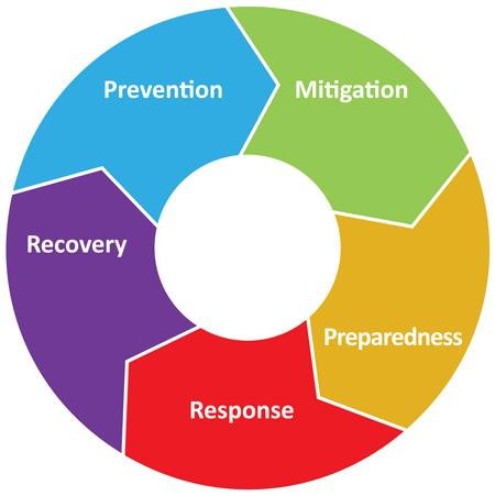
Preparedness is crucial in mitigating these threats. Residents should prioritize their safety by implementing effective strategies. Key actions include:
- Emergency kits: Assemble essential supplies such as food, water, medications, and important documents.
- Communication plans: Establish a contact list of family and friends to ensure everyone is accounted for.
- Evacuation routes: Familiarize yourself with local evacuation plans and routes, especially if you live in flood-prone areas.
| Preparation Measure | Description |
|---|---|
| Secure Property | Reinforce windows and doors, and secure outdoor furniture. |
| Stay Informed | Monitor weather updates and heed warnings from local authorities. |
| Community Support | Check in on neighbors, especially the elderly or those with disabilities. |

Preparedness Measures for Residents Ahead of the Storm
As Tropical Storm Ernesto approaches, it’s crucial for residents to take action to ensure safety and minimize potential disruptions. Begin by assembling an emergency kit that includes the essentials needed for at least 72 hours. This kit should contain:
- Non-perishable food and water
- Flashlights and batteries
- A first aid kit
- Medications and personal hygiene items
- Important documents in a waterproof container
Additionally, stay informed about the storm’s progress. Follow local weather updates through reliable sources, and heed any evacuation orders issued by authorities. Preparing your home is also key; secure outdoor items and board up windows if advised. If necessary, consult the table below for important contact numbers that could assist you during the storm:
| Service | Contact Number |
|---|---|
| Emergency Services | 911 |
| Local Shelter Information | (XXX) XXX-XXXX |
| Utilities Company | (XXX) XXX-XXXX |
| Police Department | (XXX) XXX-XXXX |

Monitoring Resources and Evacuation Protocols for Effective Response
As Tropical Storm Ernesto develops in the coming hours, it is essential to maintain a vigilant watch on available resources that will facilitate an effective response. Local authorities and emergency management agencies must ensure that the following resources are readily accessible:
- Emergency Shelters: Designate facilities equipped to accommodate displaced residents.
- Medical Supplies: Stockpile first aid kits, medications, and water purification tools.
- Communication Tools: Establish reliable channels for disseminating information to the public.
- Rescue Teams: Mobilize trained personnel equipped for swift response to any emergencies.
Meanwhile, the importance of clear evacuation protocols cannot be overstated. Residents in affected areas should be made aware of the following essential guidelines to ensure safety:
| Evacuation Steps | Description |
|---|---|
| Monitor Updates | Stay informed via local news and weather updates. |
| Pack Essentials | Gather important documents and necessary supplies. |
| Know Your Routes | Identify safe and clear paths away from high-risk areas. |
| Stay Connected | Inform family and friends of your evacuation plans. |
Q&A
Q&A: Tropical Storm Ernesto Expected to Form in Next 24 Hours, Impact Leeward Islands by Tuesday
Q: What is the current situation regarding Tropical Storm Ernesto?
A: Meteorologists are closely monitoring a disturbance in the Atlantic that is expected to develop into Tropical Storm Ernesto within the next 24 hours. The storm is forecasted to impact the Leeward Islands by Tuesday, bringing heavy rain and strong winds to the region.
Q: What exactly is a tropical storm?
A: A tropical storm is a weather system characterized by organized thunderstorms and sustained winds ranging from 39 to 73 miles per hour. It can lead to severe weather conditions, including heavy rainfall, flooding, and strong winds that can cause damage.
Q: How are the Leeward Islands preparing for Ernesto?
A: Authorities in the Leeward Islands are actively monitoring the storm and preparing emergency response plans. Residents are urged to stay informed through local news and weather advisories, stock up on essential supplies, and have an evacuation plan in place if necessary.
Q: What should residents of the Leeward Islands do in anticipation of the storm?
A: Residents should stay vigilant by keeping track of updates from reliable sources like the National Hurricane Center. It’s wise to secure outdoor items, prepare emergency kits with food, water, and medications, and make arrangements for any necessary evacuations.
Q: When will the storm reach the Leeward Islands?
A: Tropical Storm Ernesto is currently projected to make its approach to the Leeward Islands by Tuesday. Timing can vary based on the storm’s development, so it’s essential for residents to stay updated on the latest forecasts.
Q: What kind of impact can be expected from the storm?
A: While exact impacts can vary, Tropical Storm Ernesto is predicted to bring heavy rainfall, strong winds, and the potential for localized flooding and power outages. Coastal areas may also experience elevated seas and rough surf conditions.
Q: How should people stay informed during the storm?
A: Residents should rely on official channels such as the National Hurricane Center, local meteorological services, and government updates. Social media and weather apps can also provide real-time alerts, but it’s important to verify information from credible sources.
Q: In case of an emergency, what resources are available for residents?
A: Many local governments have disaster preparedness resources available, including shelters, hotlines, and emergency service contacts. Residents should familiarize themselves with local emergency services, evacuation routes, and community support programs ahead of time.
Q: Are there any long-term forecasts about Tropical Storm Ernesto?
A: Long-term forecasts suggest that Tropical Storm Ernesto may impact larger areas depending on its path and intensity. Meteorologists will continue to provide updates as the storm develops, which can help inform future expectations and preparedness actions.
Q: What should we keep in mind as the situation unfolds?
A: The most important thing to remember is to remain calm and informed. Tropical storms can change rapidly, so adaptability is key. Communities should come together to support one another during this time and prioritize safety above all.
To Wrap It Up
As we turn our gaze to the skies, all eyes are on Tropical Storm Ernesto as it gathers strength and seeks to make its mark on the Leeward Islands. While meteorologists keep a close watch and residents prepare for the potential impacts, one thing remains certain: Mother Nature is both unpredictable and powerful. Preparedness and awareness are key as we move forward; staying informed is essential in navigating the changing climate and securing our communities against nature’s whims. In the coming days, let us collectively hope for the safety of all in Ernesto’s anticipated path and remember that together, we can weather any storm.

