As the winds of change swirl over the Atlantic, the National Hurricane Center has issued an urgent update regarding Hurricane Helene, a powerful storm that is rapidly gaining strength. With forecasters predicting sustained winds of 130 mph and terrifying gusts reaching 145 mph at landfall, the threat posed by this relentless hurricane looms large. As coastal communities brace for impact, officials and residents alike face the daunting task of preparing for potential devastation. In this article, we delve into the latest forecasts, the storm’s trajectory, and the necessary precautions that individuals and families should take to safeguard themselves as Helene approaches. The clock is ticking, and the time to act is now.
Hurricane Helenes Trajectory and Impact Forecast
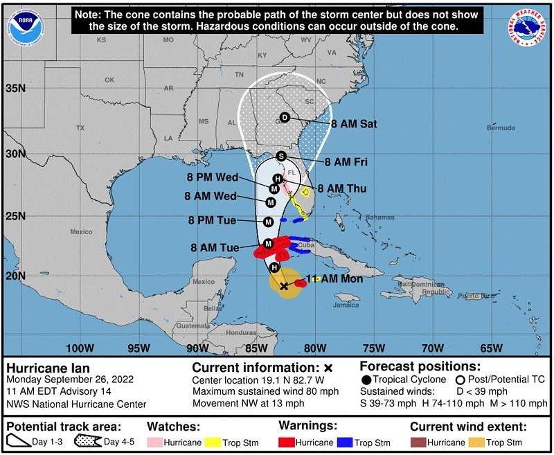
As Hurricane Helene continues its advance towards the coast, meteorologists are meticulously tracking its trajectory and projecting its potential impact. The National Hurricane Center has reported that Helene is expected to reach maximum sustained winds of 130 mph, with gusts peaking at 145 mph as it makes landfall. Experts recommend monitoring the following areas for possible effects:
- Coastal Flooding: Significant storm surge could cause major coastal flooding.
- Wind Damage: High winds pose a risk to trees, power lines, and infrastructure.
- Heavy Rainfall: Increased rainfall may lead to flash flooding in low-lying regions.
- Evacuations: Residents in high-risk areas may be advised to evacuate early.
Preparedness is crucial as the storm approaches. Emergency services are on high alert, ready to respond to any immediate needs once Helene makes landfall. To provide a clearer picture of how communities might be affected, here’s a brief overview of projected impacts by region:
| Region | Projected Wind Speed | Flood Risk |
|---|---|---|
| Southern Coast | Up to 130 mph | High |
| Central Coast | Up to 115 mph | Moderate |
| Northern Coast | Up to 95 mph | Low |
Understanding Wind Speeds: What 130 MPH and 145 MPH Gusts Mean for Coastal Areas
When wind speeds reach 130 MPH, the impact on coastal areas can be significant, as these sustained winds are often associated with intense hurricanes. Structures such as homes, businesses, and coastal infrastructure will experience extreme pressure, leading to potential damage or complete destruction. Many older buildings may not withstand such forces, especially if they are not built to modern hurricane standards. Furthermore, the physical environment is at risk, with large trees uprooted and power lines downed, contributing to widespread power outages and hazardous conditions.
The forecasted gusts of 145 MPH elevate this scenario to an even more critical level. Gusts can create additional danger beyond sustained winds, leading to unpredictable bursts of force that can shatter windows and tear roofs off buildings. Coastal communities must brace for flooding due to storm surge, as high winds push seawater inland. The aftermath can leave residents without essential services for extended periods. Therefore, preparations must include securing properties, stocking up on emergency supplies, and heeding evacuation orders, as these winds pose a severe threat to life and property.
Preparedness Strategies for Residents in Hurricane Helenes Path
As Hurricane Helene approaches with significant strength, residents are urged to take essential precautions to ensure their safety. Creating an emergency kit is essential; this kit should include items such as non-perishable food, water, medications, flashlights, batteries, and important documents. Additionally, it’s critical to develop a communication plan with family and friends to keep everyone informed, particularly if evacuation becomes necessary. Stay updated through reliable sources, including the National Hurricane Center, local news outlets, and weather apps to receive the latest developments and advisories.
Consider the following preparedness strategies to enhance your safety:
- Secure outdoor items: Bring in any furniture, decorations, or tools that could become projectiles.
- Know your evacuation routes: Plan your escape well ahead of time and familiarize yourself with roads, shelters, and potential barriers.
- Prepare your home: If possible, strengthen windows and doors, and consider using plywood or storm shutters.
- Charge devices: Ensure all mobile devices are charged, and have backup power sources ready.
| Preparedness Item | Description |
|---|---|
| Emergency Kit | Food, water, medications, batteries, documents. |
| Communication Plan | Designate contacts and check-in methods. |
| Evacuation Plan | Map routes and identify shelters. |
| Home Reinforcements | Secure windows/doors and outdoor items. |
Long-Term Climate Patterns: What This Means for Future Hurricanes
The evolving nature of our climate has direct implications for hurricane activity, shaping how meteorologists interpret trends and forecast storm intensity. Over the past few decades, researchers have observed a clear correlation between rising sea surface temperatures and increasing hurricane strength. As the atmosphere warms, it can hold more moisture, which fuels storm systems, leading to more intense hurricanes. This reality necessitates that coastal regions prepare for potentially more destructive storms, as the frequency and intensity of hurricanes appear to be on the rise.
Key factors that contribute to long-term changes in hurricane patterns include:
- Ocean Temperature: Warmer waters serve as fuel for hurricanes.
- Wind Shear: Changes in atmospheric conditions can either hinder or enhance storm development.
- El Niño and La Niña: These climate phenomena influence hurricane patterns significantly, with El Niño often suppressing activity while La Niña can enhance it.
Understanding these patterns is crucial for risk assessment and resource allocation. For a clearer perspective, consider the following table that outlines some key historical hurricanes alongside their intensity:
| Hurricane Name | Year | Max Wind Speed (MPH) | Category at Landfall |
|---|---|---|---|
| Katrina | 2005 | 175 | Category 5 |
| Harvey | 2017 | 130 | Category 4 |
| Michael | 2018 | 155 | Category 5 |
| Laura | 2020 | 150 | Category 4 |
Q&A
Q&A: Understanding Hurricane Helene and Its Potential Impact
Q1: What is Hurricane Helene, and where is it currently located?
A: Hurricane Helene is a significant tropical storm currently active in the Atlantic Ocean. As of the latest update from the National Hurricane Center, it is positioned several hundred miles away from the coastline, gathering strength as it approaches land.
Q2: What are the predicted wind speeds of Hurricane Helene?
A: Hurricane Helene is forecasted to reach sustained winds of up to 130 mph, with gusts possibly escalating to 145 mph at the time of landfall. This categorization classifies it as a powerful Category 4 hurricane on the Saffir-Simpson scale.
Q3: How does the wind speed of Hurricane Helene compare to other recent hurricanes?
A: Wind speeds of 130 mph place Hurricane Helene among the stronger storms in recent memory. For context, hurricanes are categorized on a scale from 1 to 5, with Category 1 being the weakest and Category 5 being the most destructive. Helene’s projected wind speed suggests it will have the potential for severe damage where it makes landfall.
Q4: What can residents in the predicted path of Hurricane Helene do to prepare?
A: Local authorities recommend that residents stock up on essential supplies, such as food, water, medications, and batteries. It’s also advised to secure outdoor items, reinforce windows and doors, and stay informed through reliable news sources about evacuation orders and safety protocols.
Q5: What are the potential effects of Hurricane Helene when it makes landfall?
A: When Hurricane Helene makes landfall, it is expected to cause dangerous wind conditions, coastal flooding, and heavy rainfall, potentially leading to storm surges and inland flooding. Power outages are likely due to downed trees and utility lines, and significant damage to infrastructure should be anticipated in the most affected areas.
Q6: How can individuals stay informed about Hurricane Helene’s progress?
A: People can stay updated by following alerts from the National Hurricane Center, local weather agencies, and community emergency management offices. Social media platforms and news outlets also provide real-time updates and safety information.
Q7: What should people do during the hurricane?
A: During the hurricane, it is critical to remain indoors, away from windows and external doors. Individuals should have a safety plan in place and avoid traveling unless absolutely necessary. Listening to official updates and following evacuation orders is paramount to ensuring safety.
Q8: Is there a possibility that Hurricane Helene’s path or intensity will change?
A: Yes, hurricanes are notoriously unpredictable. While current forecasts predict Helene’s strength and path, meteorologists continually monitor conditions that could alter its trajectory or intensity. Regular updates are essential for preparedness.
Q9: What is the historical context of hurricanes of similar strength?
A: Historically, hurricanes reaching similar wind speeds have led to severe impacts, including devastating infrastructure damage, widespread power outages, and loss of life. Learning from past hurricanes can help communities better prepare and respond to these natural disasters.
Q10: Where can residents access resources for further information on hurricane preparedness?
A: Residents are encouraged to visit the National Hurricane Center’s website, as well as local government and emergency management websites for guidelines on hurricane preparedness, safety resources, and recovery plans. Community preparedness forums can also provide valuable insights and support.
As Hurricane Helene approaches, staying informed and prepared is vital to minimizing risk and ensuring safety for everyone in its potential path.
Closing Remarks
As we prepare for the potential impact of Hurricane Helene, it is crucial to remain informed and vigilant. With predictions suggesting sustained winds of up to 130 mph and gusts reaching 145 mph at landfall, residents in affected regions must take this storm seriously. It serves as a reminder of nature’s power and the importance of readiness in the face of impending natural threats. As Helene approaches, we urge everyone to heed the guidance and updates from the National Hurricane Center and local authorities. Stay safe, be proactive in your preparations, and support one another as we navigate this challenge together. The storm may be fierce, but with unity and preparedness, we can weather it and emerge stronger on the other side.